

BatchData Launches Parcel Boundaries, Adding Land Parcel Outlines to Its Property Data APIs and Bulk Files
News originally published by
EIN Presswire
Illustrative overlay on a stock aerial, not verified parcel geometry. The Area row names the unit, square feet; no numeric area or measured value is shown for the pictured property.
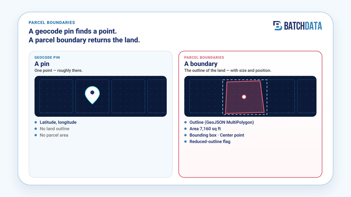
Side-by-side: a geocode pin returns a point; Parcel Boundaries returns the GeoJSON outline, area, bounding box, center point, and reduced-outline flag.
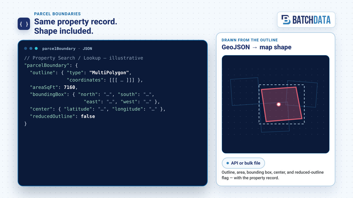
Illustrative JSON from Parcel Boundaries: GeoJSON MultiPolygon outline, area, bounding box, center point, and reduced-outline flag — delivered with the property record by API or bulk file.
The outline, area, and center point of a property's land parcel now come back with the property record, with no separate geospatial dataset to buy or match
PHOENIX, AZ, UNITED STATES, November 10, 2026 /EINPresswire.com/ -- BatchData, a provider of real estate data, APIs, and AI solutions, today launched Parcel Boundaries, an add-on to BatchData Property Data. It returns the outline of a property's land parcel as GeoJSON, along with the parcel's area, bounding box, and center point. PropTech platforms, insurance and risk teams, real estate investors, mapping and analytics teams, and home services companies can now map and measure the lot behind a property record from the same API call or bulk file they already use.
Parcel Boundaries draws on parcel maps from across the U.S. and is matched to properties in BatchData's nationwide dataset of more than 169 million parcels and 131 million properties. The outline comes back in the same response as the property record, through the Property Search and Property Lookup APIs and the bulk files teams already use, so there is no second dataset to source, clean, and match to addresses.
"For most teams, parcel data has been a separate purchase," said Ivo Draginov, President and Co-Founder of BatchData. "They buy parcel shapes from one vendor and property data from another, then match the two by address on their own. We put the parcel inside the property record, so that work is done before the data reaches them. A developer gets a lot outline on a map from one call. An underwriter, an investor, or a home services company sees the lot before the next decision."
How teams use Parcel Boundaries
PropTech and software platforms. Product teams can show parcel shapes on property pages, search maps, and dashboards from the property data API calls they already make. Standard GeoJSON loads into common mapping libraries and GIS tools, and the center point and bounding box help place map pins and frame the map view.
Insurance and risk. Underwriting and risk teams can view a property's parcel outline and area next to its property attributes as one input to their own review, and can see the extent of the land parcel tied to a policy or a submission.
Real estate investors and investor platforms. Investors can check lot size and shape during deal screening, next to ownership and property details. Platforms that serve investors can add parcel visuals and lot area to property pages and list filters.
Mapping, data, and analytics teams. Analysts can load parcel outlines in bulk into their data warehouse, join them to their own geographic layers, and analyze parcels at portfolio or market scale.
Home services. Roofing, solar, HVAC, plumbing, pest control, and remodeling companies can review a lead's lot shape and size before a site visit, sort prospect lists by parcel area, and draw parcel outlines on territory and canvassing maps. Because the outline comes with the property and owner details, it can go into CRM, routing, or mapping tools that accept GeoJSON, next to the lead it belongs to. Learn more about BatchData for home services.
What Parcel Boundaries includes
Each matched parcel boundary record includes:
- Parcel outline as GeoJSON, always delivered as a MultiPolygon, in WGS 84 longitude/latitude coordinates
- Parcel area in square feet
- Bounding box for the parcel
- Center point of the parcel
- Reduced-outline flag that marks outlines that have been simplified
Every outline is a MultiPolygon, also for a parcel with one shape, so developers handle one geometry type.
How it is delivered
Parcel Boundaries is available through the same channels as the rest of BatchData's property data:
- APIs: Applications request the parcel boundary dataset in a Property Search or Property Lookup call, part of BatchData's real estate data API solutions, and get the outline with the rest of the property record.
- Bulk files: For portfolio, market, or nationwide analysis, Parcel Boundaries is available as bulk property data in CSV, JSON, or Parquet, delivered to Amazon S3, SFTP, or Google Drive, or to Snowflake and Databricks through BatchData Cloud Delivery.
Availability
Parcel Boundaries is available now as an add-on to BatchData Property Data. To learn more or request access, visit the Parcel Boundaries page or email sales@batchdata.com.
About BatchData
Founded in 2018, BatchData is a leading provider of property data and predictive intelligence for the real estate ecosystem. Built by industry experts, BatchData has established one of the deepest and most accurate data lakes in the property technology sector, delivering instant access to over 169 million U.S. property records. The platform empowers businesses, ranging from proptech startups and home service companies to enterprise institutions, with robust APIs, bulk data solutions, and AI-powered insights. By transforming complex public records into actionable intelligence, BatchData fuels decision-making for investors, lenders, and home service providers nationwide. For more information, visit www.BatchData.io.
Media Contact
BatchData
sales@batchdata.com (please put "Press inquiry" in the subject line)
###
Ivo Draginov
BatchData
sales@batchdata.com
Visit us on social media:
LinkedIn
X
Legal Disclaimer:
EIN Presswire provides this news content "as is" without warranty of any kind. We do not accept any responsibility or liability for the accuracy, content, images, videos, licenses, completeness, legality, or reliability of the information contained in this article. If you have any complaints or copyright issues related to this article, kindly contact the author above.
